I woke up this morning with no plans of doing anything, but last minute we decided to go on a hike. Here in Tennessee, it’s been pouring rain for days and flood watches and warnings have come and gone. Ultimately, we decided on tackling Rainbow Falls with hopes of running into few people.
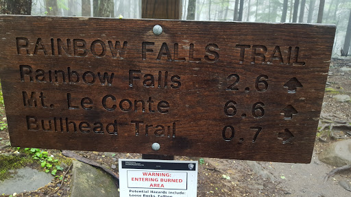
We departed Knoxville via Chapmen Highway enroute to Gatlinburg. Our directions pointed us towards turning onto Historic Nature Trail at Light #8. It s a very nice road way and super easy to find the trailhead. Did I mention it has been raining constantly throughout our drive to the trail? For those of you who need it, there are facilities at the trailhead. From what I’ve been told, this is a very popular area during tourist season, and there are many parking locations, so get there early if possible. Anywho, the National Park Service states that the trail is 2.7 miles up and approximately 5.5 round trip.
About 0.1 miles from the parking lot, you will find the trail split. If you go right, you can take the Bull Head Trail which also goes to Rainbow Falls. This is a great option if the water level is high. If you go straight, you will stay on the Rainbow Falls trail. If you go left, you will head towards Trillum Gap Trail and Grotto Falls Trail.
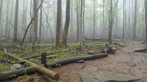
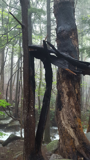
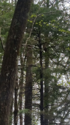
What we quickly discovered is that we would be hiking through a major burn area. For those of you know don’t know, in November 2016, the Monday after Thanksgiving, Gatlinburg and the Eastern Tennessee area was severely damaged from a series of wildfires. Though we noticed this quickly during our drive in, it became more present during our hike towards the falls. This gave us many memories of the weeks of smoke that clouded the skies, constantly reading to discover the areas affected and the concerns of what would happen to our beloved Great Smoky Mountains.
We continued to hike, and of course, ran into several issues. Ashley’s Fitbit stopped recording and we restarted hers. Believe it or not, within 15 minutes, my Fitbit also “finished the workout” and needed to be restarted.
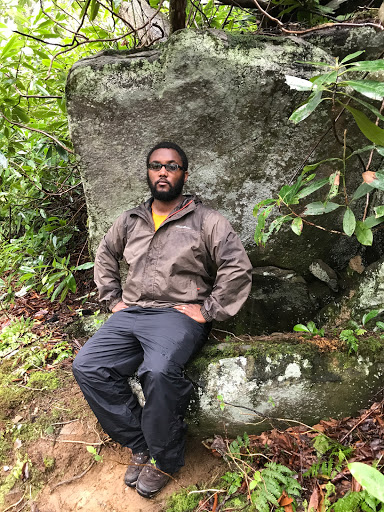
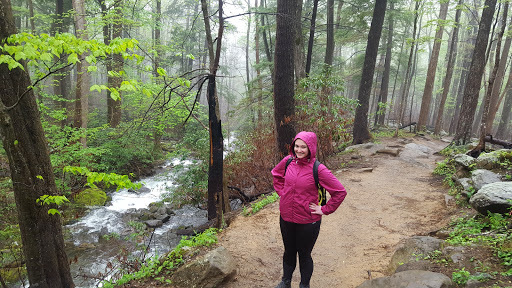
One of the joys of the this hike is the ability to hike next to Le Conte Creek. Since typically the wife is behind the camera, I tried to snag her photo.
We continued to hike and enjoyed the wildlife. The birds were singing, ran into a couple of chipmunks, and then we heard an unidentifiable sound. After taking a couple more steps, we were able to see a large owl sitting on a branch. A quick Google search shows that we may have ran into an adult Barred Owl. Check out this link to hear what they sound like. Follow this link to learn more about the Barred Owl from the TWRA.
We continued along our way in hopes of finding more places to enjoy, more sights to see, and a waterfall to celebrate at. There is a small foot bridge you cross roughly 1 mile from the falls. Otherwise, there are many places where we see a lot of water and a couple locations where you have to cross water. This first location wasn’t so bad, but Ashley definitely stepped into the water.

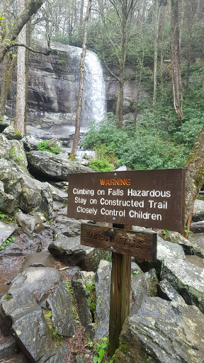
After checking Gaia GPS ($20 gps app for iOS and Android, review coming soon), Hiking Project (REI’s hiking and backpacking app, comparison review coming soon), and Fitbits galore, we realized we were close to the falls. So close, that we looked up and could see the falls. We had one last water crossing, and saw no way we could cross without diving in the water. The water level was quite high, and we decided that we would dive deep into the water. Has anyone ever told you that mountain water is cold? We made it to the base of Rainbow Falls and took many photos to enjoy our latest achievement.
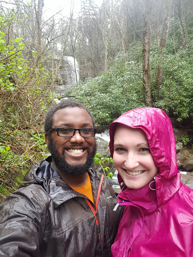
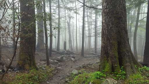
We started our decent down the mountain and the fog began to set in deep. It began to look eerie, so we thought that it would be a great time to take another photo!
Our decent was quit simple, without any major issues. There was that one time that I felt like a kid again…
We ran into a few people as we walked down the trail. We tried to honestly tell people how far away the trails were. We finally made it to the end of our hike. We were greatly surprised that we made it to the end, especially as fast as we did. The last group we ran into wanted to know all about how to reach the trailhead, which directions we took and more.
At the end of our adventure, this is what we determined:
– Ashley’s Fitbit determined we hiked 6.65 miles
– Gaia GPS stated we hiked 5.51 miles
Still looking into what makes Fitbit so different from GPS if it tracks via a person’s average pace. At the end of the day, we enjoyed our amazing hike, rain and all! It’s definitely an amazing hike, and it would be the direction I would come down after hiking to Mt. Le Conte. I’m hoping that with more training, I will be able to hike Mt. Le Conte via Alum Cave up and Rainbow Falls down during late summer or early fall. I’ll keep you posted! Until next time, hike safe.

thanks for the post live in east tennessee and always glad to learn of new hikes
LikeLike